 an open source tool for geospatial
image exploitation
OpenEV Design Features
-
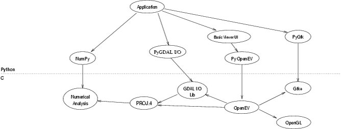
Developed using a combination of C,
Python, GTK+, PyGTK, OpenGL, and Numerical Python.
-
Use of hardware acceleration for continuous
zoom, sub-pixel bilinear interpolation, on-the-fly projection and texture
mapping (2-D and 3-D)
-
Use of on-the-fly handling of multiple
levels of detail (creation and caching) avoids a pre-processing requirement
-
Support for tiled, pre-built overviews
maximizes performance for very large files
-
OpenGL: for high speed raster and vector
rendering in accelerated environments. Texture mapping is used for raster
display


